You can read a lot more about the revitalization of the Queens Quay area on their website. Specifically, you can read a useful December 2008 presentation on the redevelopment of the road in this huge but very readable PDF.
Option 2: Centre transit with on street bike lanes. You can see the difference already and that is that vehicle traffic would be hit. There would be on street parking and in addition, bike lanes, which would mean that both east and west bound traffic would be limited to one lane. You can see that on busy days, the traffic would really down to a crawl, but for cyclists, that would definitely help navigate an area with tonnes of buses and parked cars.

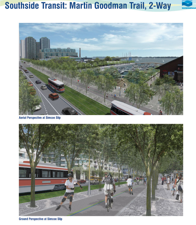
Option 4: South transit with MGT and two-way operation: So, expanded Martin Goodman Trail plus more greenery, the whole south side of the streetcars would be pedestrian/cyclists. The north would be two way.
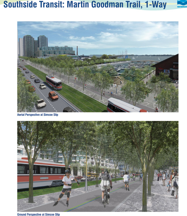
Option 5: South transit with MGT and one-way operation: Like No. 4 but with westbound only traffic.
The bike lane option, we think, doesn't go far enough and does not make the street any more approachable or walkable by pedestrians.
The one-way street concept is interesting but it would be kind of unmanagable because it is a long waterfront and people need to get to different places (ferry docks, the central waterfront, the condos, or just parking for Rogers Center.)

Here are some of the factors that they wanted to keep in mind. Looking at the list below, we think No. 4 is the no brainer.:
Land use and planning and policy context
Urban design and public realm (streetscape, public spaces, cyclists, pedestrians)
Transportation - transit and vehicles, safety, emergency vehicles
Social economic environment - tourism, effects on business, residents
Natural environment - air quality, aquatic habitats
Cultural environment
Cost

What about no traffic? This is a waterfront, not another highway. There's a huge highway there. People can park and streetcar, walk or bike. And those living there should be able to walk to work. In the downtown of such a huge city, there's no reason to own a car.
ReplyDelete